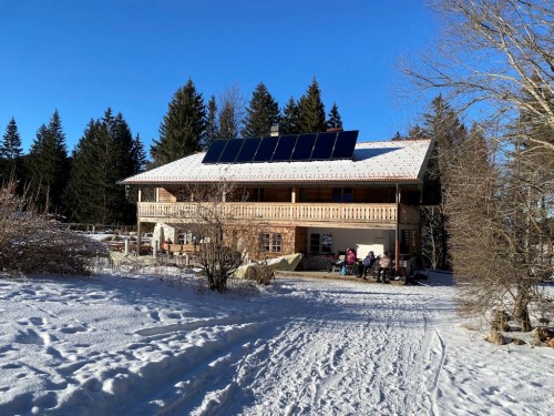
Winter hiking in the holiday region Chiemsee-Chiemgau
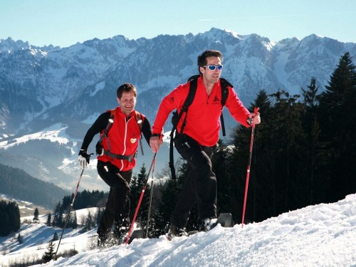
Snow-shoeing is the natural experience in its most beautiful form.
Winter hiking is movement, relaxation away from hustle and bustle. In the heart of the Chiemgau Prealps you will be able to recharge your batteries in an intact environment surrounded by the backdrop of the "Bavarian Alps". It is the lonely silence of the fresh snowy winter forest, which you will find everywhere in the holiday region Chiemgsee-Chiemgau. Cleared hiking trails in the rattling snow with wonderful
rest stops.
It does not take much to convince yourself of snowshoe hikes!
Whether it is the lonely silence of the fresh snowy winter forest or the quiet nature, it is recreation from the daily stress. It is the way you pull the first trail through the virgin snow ... Enjoy the winter magic on the snowy slopes, forests and mountain peaks and then a Kaiserschmarrn in one of the cozy Chiemgau alps.
From Unterwössen or Marquartstein to the Hochgern
Winter mountain hike to the Agergschwendalm
(Open in good weather), Enzianhütte (Monday's rest day) and Hochgernhaus approx. 4 hrs. Or to the summit 5 hrs. This tour takes about 900 heights. Even for the locals, who has often climbed him, the "pleasure" is always a worthwhile goal. Almost unobstructed view into the valley and the ever more impressive neighboring mountains; Cozy restaurants, in short, a Chiemgauer mountain wanderer delicious.
From Bergen Maxhütte to Bründling Alm at Hochfelln
Hiking park about 1 km after the Maxhütte. Here one goes on the so-called Sommerweg up to the middle station of the Hochfellnbahn. Under the Hochfellnbahn you will come across a path on the forest path, which leads to the Öder Kaser to Bründling Alm (also open in winter). You can also take the Hochfellnbahn to the middle station, then you have about 30 min To the alpine pastures.
From Frasdorf to Frasdorfer Hütte and Riesenhütte
In the center of Fradorf you turn left in the direction of Schafsberg, before you turn right to the Lederstube hiking park. From there it's about 45 minutes. To the Frasdorfer Hütte called "the Frase" (Monday, Tuesday closed) and then again about 45 minutes to the Riesenhütte. Cottages have opened in winter, except in November.
From Marquartstein Hochplattenbahn via Staffnalm to Hochplatte
From the parking lot of the newly renovated Hochplattenbahn about 1 hour to the Staffnalm (Monday, Tuesday rest day) then about 1 1/2 hours to the summit
Reit im Winkl with the first premium winter hiking trail
Route description
from "Sulzen-Kaser" at the Hemmersuppenalm
Reit im Winkl offers
more than 40 km of freshly-groomed winter hiking trails in the valley and on the
hillsides Winklmoos-Alm and Hemmersuppen-Alm (as the first ripped premium winter
wall trail). The entire winter hiking trails, whether in the valley
or on the heights, are characterized by the fact that they lead through the
winter landscapes and are not cleared but are rolled, so the winter hiker always
has a walkable snow bed. The routes can be easily combined with
lengths of 2-20 km. Guided tours regularly take place on our winter
hiking trails.
From Reit im Winkl to Loferau - Grenzsteg
The starting point of this hike is the cross-country skiing area on Tirolerstraße. The path leads south-westwards across the Loferauen to the Grenzsteg (the trail runs roughly parallel to the cross-country trail 3). On the border crossing you cross the Lofer. After crossing the border, turn left, first parallel to the crossroads 3, then through a small forest to an open forest barrier. After the barrier the path turns to the right and goes through a small forest and then to a free area again to the left back to the trail to Krautloidersteg (stopover). After the footbridge, go to the right, always along the cross-country ski run (please do not go on the cross-country ski trail) over the Loferausiedlung back to Reit im Winkl.
From Reit im Winkl to Oberbichl
The starting point of this hike is again the cross-country ski run on the Tirolerstraße. The path leads to Loferau to the southwest. After crossing the "Hausbach", head northwards to the "Tirolerstraße", cross it and cross the slope to the golf course site and then to Oberbichl / Birnbach. In front of the Gasthof Stoaner continue eastwards over the golf course to Oberbichl. Here you can go back on the road to Unterbichl or on the Birnbacherstraße back to Reit im Winkl.
Ruhpolding
Ruhpolding has a 50 km long network of cleared hiking trails in the very nature!
Rauschbergbahn
GmbH
- Knogl 12 (Alpine Road) - 83324
Ruhpolding
phone: 08663-5945 - fax: 08663-800285 - phone
Info: 08663-1381
http://www.rauschbergbahn.com/ - e-Mail:
rauschbergbahn@t-online.de
Winterwandungen on
the Rauschberg every day from 9:15 am to 5 pm. In approx. 4 -6
minutes come
To the peak of the "Rauschbergbahn" (1626
m). There are 20 persons in the cabins.
Place.
3 km of cleared hiking trails in the high mountains
Rental service for sleds and snowshoes (if necessary with guide).
Best tour area. The sky very close ........ Sunshine on the
Rauschberg. Relax in the comfortable beach chairs, the panoramic
view on the
Enjoy the mountain station terrace ... and then up
to the summit cross.
Hike to Brandler Alm!
From Traunstein through the Ruhpoldinger Ortsumgehnenstunnel to the traffic light at the end of the town. Here you turn left and then to Zell. Here you can find a parking lot and go up to the Brandler Alm.
Inzell
With more than 50 kilometers of cleared and rolled winter paths, Inzell offers countless possibilities to explore the snow-covered mountain world. The 7 most beautiful hikes reveal the Wintersport map of Inzell: from the cozy Sonnenrunde at Teisenberg to the sporty trip to the Bäckeralm with a view of the Inzeller valley.
Around the Falkenstein
The hike begins at the parking area of the ice stadium. The 2 hours long hike takes you through the nature reserve Falkenstein. This hike is without any major ascents and therefore suitable for all. From this hike there are very nice retreats at Landgasthof Binderhäusl (Wednesday closed) and at the Gasthof Zwing (Thursday closed).
The Frillensee round
The 3 hour long hiking tour starts at the parking lot Gasthof zum Gaßl. A tour for enduring hikers who have to overcome the 220 altimeters. As he gets an impressive landscape. If you want to have it shorter, start at the parking lot in Adlgaß. There is a nice place to stop in the Gasthof zum Gaßl (rest day Thursday and Friday, respectively, until 2 pm) or in the Adlgass Fort (Tuesday rest day).
